Rainfall update, 11 July 2018
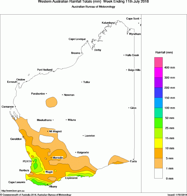
Rainfall over the past week has been heaviest in the lower west and coastal parts of the south. Most of grainbelt has received less than 10mm for the week.
Rainfall totals in the past week
For more information refer to the Bureau of Meteorology weekly rainfall table for the south-west.
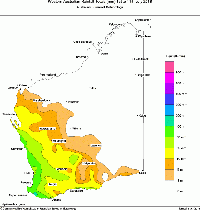
Rainfall for the month to date
The month began with good falls along the west coast and northern grainbelt. The south coast and far north-east of the grainbelt have received mostly less than 25mm so far.
Monthly rainfall to date is available from the DPIRD weather stations and radar page (select Month to Date from the drop-down menu).
Seasonal rainfall
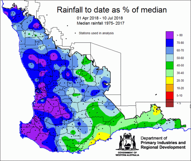
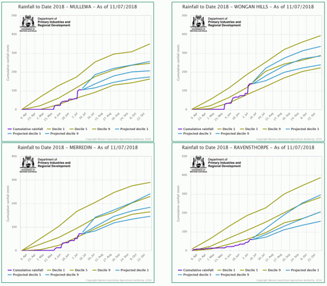
Good rain in early July has advanced much of the northern grainbelt to be close to median rain to date (Figure 3). South-eastern and eastern parts of the grainbelt remain well below seasonal median rain to date. See Figure 4 for examples from DPIRD’s rainfall to date tool.
Soil moisture
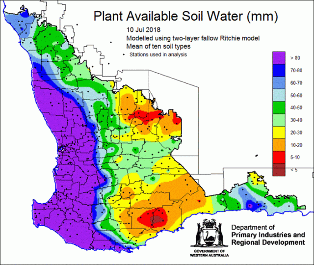
Figure 5 shows the estimated fallow soil water storage to 10 July 2018 from the DPIRD soil model. Rain since 1 July has been mostly less than 25mm, so north-eastern and south parts of the grainbelt have low levels of soil water storage.
The Seasonal climate information page now shows soil water storage for each of the 10 soil types used in the model.
Potential yield
Potential crop yield is estimated using the French-Schultz relation and uses seasonal rainfall from1 April to date. The rest of the growing season to 30 September is assumed to be decile 5. This model does not account for crop diseases or soil constraints.

Rainfall forecast for the next week
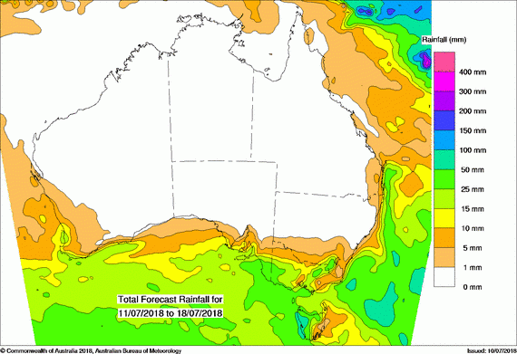
Rainfall forecast for the week ending 18 July 2018 is likely to be modest over the grainbelt; totals appear to be less than 10mm (Figure 7).
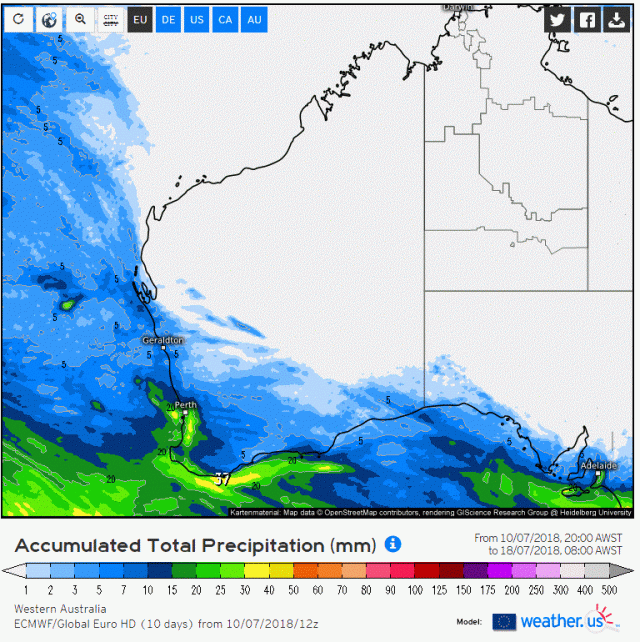
The ECMWF model is predicting a similar spatial pattern of rainfall over the coming week. Total predicted rainfall from the ECMWF model for the next 10 days is shown in Figure 8.
