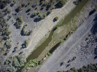
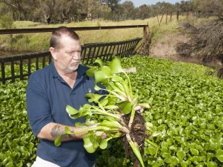
The Department of Agriculture and Food recently commissioned unmanned drones to take photographs along the Serpentine River and sent selected images electronically to Landcare Serpentine-Jarrahdale group to inspect for the presence of water hyacinth.
Department biosecurity officer David Hill said the weed was initially reported in the Serpentine River in June 2015.
“Water hyacinth has the potential to block large sections of the river and spread into other waterways,” Mr Hill said.
“The upper reaches of the river flow into the Serpentine Dam, which provides drinking water to the Perth metropolitan area, so once the weed was spotted immediate action was taken by local landholders to control the infestation before it could spread.
“Previously, surveillance measures included water hyacinth surveys conducted on the ground by two people and a helicopter flying over the river and treating the infestation.
“It was recognised that, in partnership with the community, a drone could be a more effective and cost-efficient way to survey the river for untreated water hyacinth.
“This presented an opportunity for the department’s Boosting Biosecurity Defences project’s ‘Agricultural weed surveillance in the South West to protect industry profitability’ sub-project to undertake a drone trial in liaison with the community.”
The trial involved a fixed-wing drone taking thousands of images along a 27 kilometre by 150 metre section of the Serpentine River.
The images were very high quality and had GPS coordinates embedded in the file.
Prior to the commencement of the trial, training images were provided to allow the Landcare Serpentine-Jarrahdale group’s members to familiarise themselves with the imagery and develop their detection skills.
Mr Hill said throughout the trial, the group evaluated about 16 000 images, twice to improve reliability, reducing them to 105 images that contained water hyacinth.
“Information gained from our collaboration with the local landcare group will be used to accurately map the distribution and density of water hyacinth weed infestation along the Serpentine River, significantly reducing the costs associated with the management of this declared plant,” Mr Hill said.
“A follow-up helicopter survey of the Serpentine River was conducted on 9 March 2017 to provide a comparison of survey outcomes, and data collected during the flight is being analysed.”
The department encourages Serpentine locals to continue to look out for the water hyacinth and report sightings to the department via the MyWeedWatcher app.
Water hyacinth can form a thick mat on the surface of rivers and lakes and reduce water quality. The plant has thick, leathery leaves and produces pretty, purple flowers.
The drone trial complements the department’s MyWeedWatcher app initiative, launched in 2016, to implement innovative methods of weed detection, involving the community, to boost surveillance and early detection.
The department’s Boosting Biosecurity Defences project was made possible by Royalties for Regions.


Media contacts: Jodie Thomson/Dionne Tindale, media liaison +61 (0)8 9368 3937
