Background
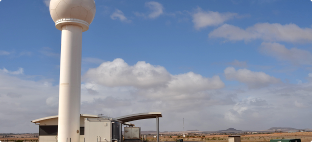
Coastal communities and agricultural producers are now benefiting from this completed project that has seen the weather monitoring services at Albany, Geraldton and Esperance upgraded to Doppler radar capability.
Work has now been completed at all three coastal sites (completed in 2020) and the new coastal Doppler radars' data may be accessed via DPIRD's upgraded weather website.
The State Government has funded the upgrades at Albany and Geraldton contributing $4.6 million towards these upgrades – with the breakdown constituting $2.3 million for Albany and the remaining $2.3 million going to the Geraldton enhancements.
The Bureau of Meteorology (BoM) has also provided Federal funds for the Esperance upgrade.
All three radars are now back online.
The additional Doppler radar data will complement information from DPIRD’s extensive weather station network, and its three existing Doppler radars at South Doodlakine, Newdegate and Watheroo, to assist agribusiness decisions.
Benefits of Doppler radar technology to agriculture
Technology is an increasingly important management tool in ensuring our State’s agricultural sector remains internationally competitive in the face of widespread technology adoption in competitor markets, such as the United States and Europe.
At a time of more erratic weather patterns, strategic investment into this infrastructure enables more informed decisions ensuring expensive farm inputs are applied more efficiently and effectively.
Doppler radar images provide farm businesses with improved information on prevailing weather conditions, enabling them to make more timely strategic and accurate decisions around time of sowing, chemical and fertiliser applications and movement of stock, potentially resulting in significant savings.
The now completed nearly full Doppler radar coverage across the WA grainbelt will enhance community safety and assist in emergency response capacity, especially during severe weather events and bushfires.
The upgraded radars will also greatly improve the coverage of the extensive maritime activities operating in these regions.
This technology enables innovative insurance products to be developed to better protect farm business incomes from the vagaries of climate.
Learn more about the investment into Doppler radar technology.


